Babusar Pass (Babusar Top) Travel Guide: Routes, Weather & Travel Tips
There are road trips… and then there are road trips that stay with you forever. Babusar Pass is firmly in the second category.
Sitting at a breathtaking height of over 4,100 meters, this iconic mountain pass connects the lush greens of Kaghan Valley with the raw, dramatic landscapes of Gilgit-Baltistan. One moment you’re driving through pine forests and rivers, and the next, you’re above the clouds wondering how Pakistan manages to pack so much beauty into one route.
If you’re planning a trip up north, Babusar Top isn’t just a stop — it’s an experience. This guide covers everything you need to know before heading there, from routes and road conditions to weather, safety, and what to expect once you’re standing at the top.
Table of Contents
- Overview of Babusar Pass
- Why Babusar Pass is Worth the Hype
- Location and Map Insights
- Height and Geographic Facts
- History and Cultural Significance
- Routes to Babusar Pass
- Road Conditions and Accessibility
- Best Time to Visit Babusar Pass
- Weather Conditions at Babusar Top
- Things to Do at Babusar Pass
- What to Pack for the Trip
- Travel Safety Tips
- Nearby Attractions
- Is Babusar Pass Suitable for Families?
- FAQs
Overview of Babusar Pass
Babusar Pass, often called Babusar Top, marks the highest point of the Kaghan Valley that you can actually drive to. It connects Naran to Chilas, acting as a natural bridge between two completely different landscapes.
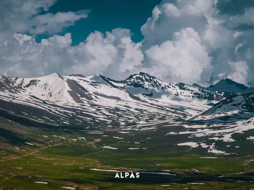
On one side, you have green valleys, flowing rivers, and alpine meadows. On the other, a rugged, almost desert-like terrain shaped by glaciers and mountains. It’s this contrast that makes the journey feel like you’re traveling through multiple worlds in just a few hours.
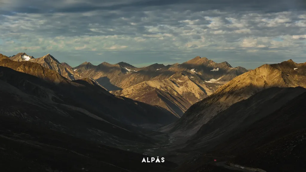
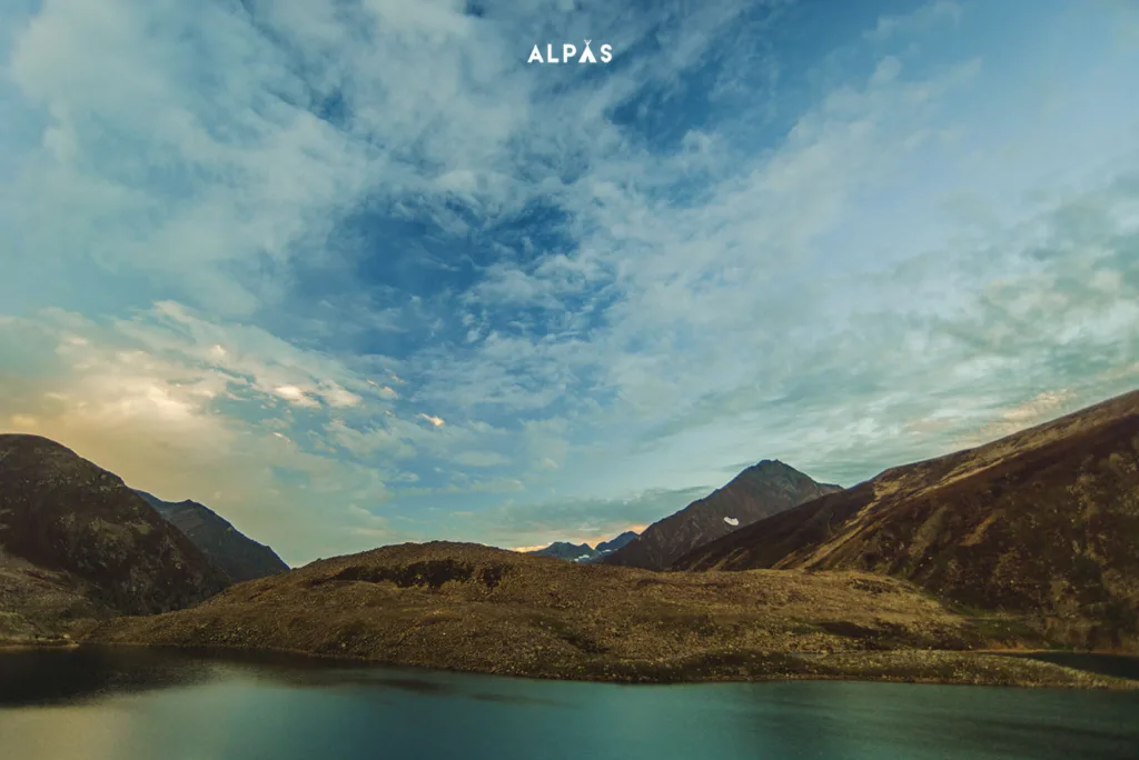
And then there’s the view. On a clear day, you might catch a glimpse of mighty peaks like Nanga Parbat and Malika Parbat standing tall in the distance.
Why Babusar Pass is Worth the Hype
There’s a reason Babusar Top keeps popping up on every traveler’s bucket list.
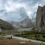
It’s not just about getting there, it’s about everything that happens along the way. The scenery shifts dramatically as you gain altitude, the air gets thinner, and suddenly you’re driving above the clouds with mountains stretching endlessly around you.
The road itself is an adventure. Twisting turns, steep climbs, and panoramic views at every corner make it one of the most thrilling drives in northern Pakistan. It’s the kind of route where you’ll stop every few minutes, not because you have to, but because you just can’t not take a photo.
And beyond the views, there’s something deeper. This pass has been a historical route for traders, travelers, and local communities for generations. It’s not just a road, it’s a story carved into the mountains.
Location and Map Insights
Babusar Pass sits at the northern end of Kaghan Valley in Khyber Pakhtunkhwa, right at the edge of Gilgit-Baltistan.
If you’re coming from the south, your journey starts from cities like Islamabad, moving through Balakot and Naran before climbing up to Babusar Top. From the north, the route connects to Chilas and the legendary Karakoram Highway.
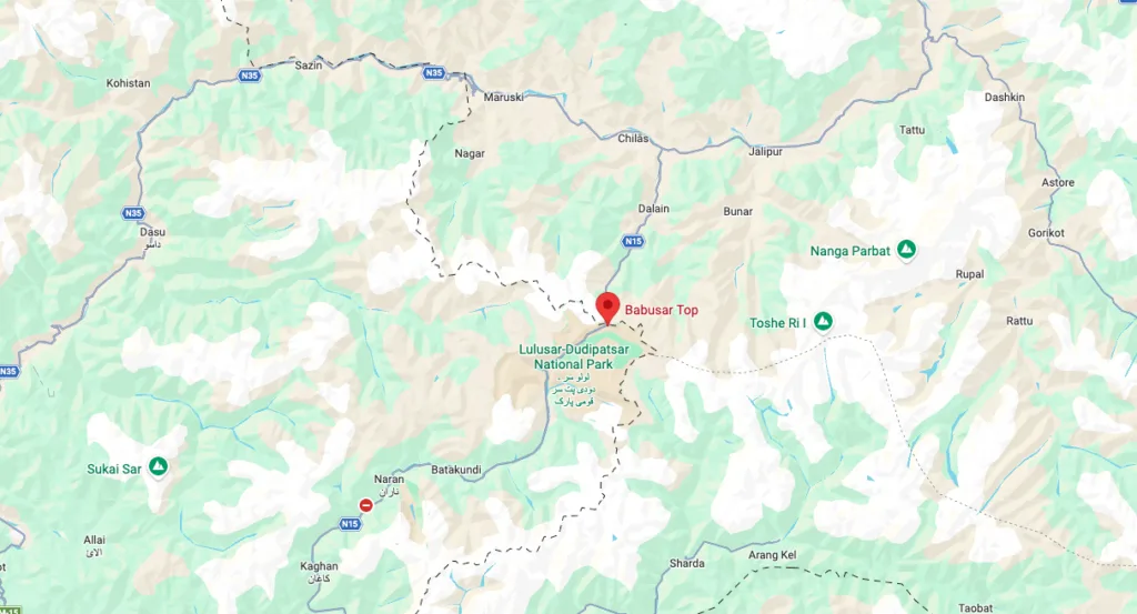
This makes Babusar Pass one of the most scenic alternative routes for travelers heading towards Hunza, Skardu, or other northern destinations.
Height and Geographic Facts
At 4,173 meters above sea level, Babusar Top is one of the highest drivable mountain passes in Pakistan.
At this altitude, you’ll definitely feel the difference. The air is thinner, the temperature drops quickly, and even simple walks can leave you slightly breathless.
The terrain up here is raw and minimal. You won’t see dense forests anymore. Instead, it’s rocky slopes, patches of snow, and wide open skies that feel almost unreal.
Even in peak summer, you’ll often find snow resting quietly along the roadside, reminding you that this place belongs to the mountains, not us.
History and Cultural Significance
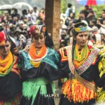
Long before tourists discovered Babusar Pass, it was already an important route connecting regions and cultures.
Traders, shepherds, and travelers used this passage for centuries, moving between valleys and carrying goods across regions. It played a quiet but crucial role in shaping the local economies and connections between communities.
There’s also an interesting story behind its name. Some believe it comes from “Babur Top,” linked to the Mughal emperor Babur, who is said to have passed through this region. Over time, the name evolved into Babusar, but the legend stuck around.
Routes to Babusar Pass
The most popular route is from Naran, and honestly, it’s the one you should take if you’re visiting for the first time.
The distance from Naran to Babusar Top is roughly 65 kilometers and takes about two hours, though realistically it takes longer because you’ll keep stopping for photos.
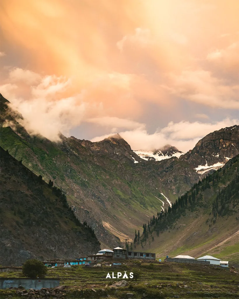
Along the way, you pass through Batakundi, Jhalkhad, and the stunning Lulusar Lake, which is easily one of the highlights of the journey.
The Chilas route, on the other hand, is longer and a bit more rugged. It offers dramatic views of the Indus River and a completely different landscape, making it ideal if you’re coming from Gilgit-Baltistan.
Road Conditions and Accessibility
The good news is that Babusar Pass is much more accessible now than it used to be.
Most of the road is paved, especially on the Naran side. However, conditions can still vary depending on the season. Early summer might have melting snow, while late summer usually offers the best driving experience.
Regular cars can make it, but you need to drive carefully. If you have a 4×4, even better. It just gives you more confidence on steep climbs and rough patches.
Motorcyclists love this route too, but it’s definitely not for beginners.
Best Time to Visit Babusar Pass
Timing your visit right can make or break your experience.
The best time to visit Babusar Pass is between mid-June and September. That’s when the roads are open, the weather is relatively stable, and the views are at their best.
July and August are peak months, with the most accessible conditions. June is quieter but slightly unpredictable, while September offers clearer skies with fewer crowds but colder temperatures.
Outside these months, the pass is closed due to heavy snowfall.
Weather Conditions at Babusar Top
Weather at Babusar Top has a personality of its own.
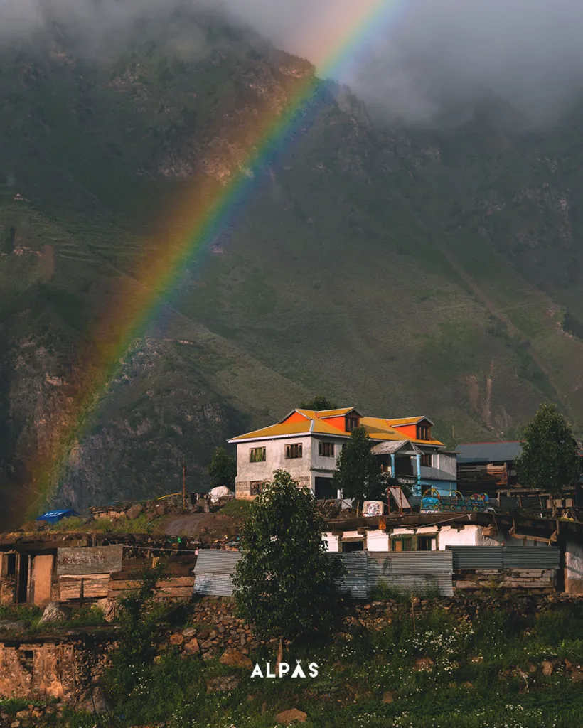
Even in summer, temperatures stay cool, usually between 3 to 11 degrees Celsius. Mornings are often clear and perfect for views, while afternoons can bring clouds, fog, or even sudden rain.
Winters are a completely different story. The pass gets buried under heavy snow and remains inaccessible for months.
The biggest thing to remember is that weather changes fast here. One moment it’s sunny, the next you’re surrounded by fog with visibility dropping instantly.
Things to Do at Babusar Pass
Once you reach the top, the first thing you’ll probably do is just stand there and take it all in.
The views are massive. Mountains in every direction, clouds drifting below, and a sense of scale that’s hard to describe.
Photography is a big one here. Every angle feels like a postcard.
You can also take short walks around the summit area. Nothing too intense, just enough to explore and soak in the surroundings. Just remember, the altitude is real, so take it slow.
What to Pack for the Trip
Packing for Babusar isn’t complicated, but it needs to be smart.
Even in summer, it gets cold at the top, so layers are your best friend. A jacket, comfortable shoes, sunglasses, and sunscreen are must-haves.
There aren’t many facilities at the top, so carry snacks, water, and some cash. And yes, your phone signal will probably disappear right when you need it most.
Travel Safety Tips
Driving to Babusar Pass is safe if done right.
Start early in the day, keep an eye on weather conditions, and avoid traveling after dark. The roads are narrow in parts, and visibility can drop quickly.
Altitude can also affect some people, so stay hydrated and take breaks if needed.
And most importantly, don’t rush. This isn’t a race. It’s a journey.
Nearby Attractions
One of the best things about Babusar Pass is that it fits perfectly into a larger trip.
You’ve got Naran for a comfortable stay, Kaghan Valley for exploring, and Lulusar Lake for those unreal reflections.
If you’re heading north, Chilas opens the door to even bigger adventures across Gilgit-Baltistan.
Is Babusar Pass Suitable for Families?
Yes, but with a bit of planning.
The journey is long and the altitude is high, so it’s important that everyone is comfortable with travel and changing weather conditions.
For families, it’s best to take it slow, stay overnight in Naran, and avoid rushing the trip.
FAQs
How high is Babusar Pass?
It sits at 4,173 meters above sea level.
Is Babusar Pass open all year?
No, it’s usually open from June to October depending on weather.
How long does it take to reach Babusar Top?
Around 2 hours from Naran and 3 to 4 hours from Chilas.
Is Babusar Pass dangerous?
Not if you travel during the day and in good weather conditions.
Final Thoughts
Babusar Pass is one of those places that reminds you why you travel in the first place.
It’s not just about reaching the top, it’s about the journey, the views, the unpredictability, and that quiet moment when you realize how small you are in the middle of these massive mountains.
Plan Your Babusar Trip with Alpas Travels
If you want to experience Babusar Pass without the stress of planning, Alpas Travels has you covered. From curated northern tours to seamless road trips, we make sure your journey is as smooth as the roads on a good day at Babusar.
Check out our northern Pakistan trips or get in touch with us to start planning your next mountain escape.

There are no reviews yet.